Day 12 July 13, 2024 Continental Divide Lodge British Columbia to Whitehorse Yukon Territory 188 miles
We went to bed early last night so we got up earlier this morning. Besides it gets light very early and the window shades are not that good. The shower is tepid at best and the water sprays everywhere. The shower stall is so small you can’t move out of the spray. For sure your shower is short. But we ran the water quite some time hoping it would get warm. The showers for the campground are labeled as cold. The water at the sink is very hot.
We went over to the little restaurant for breakfast. We determined that the lady who runs it makes her own bread, muffins and cinnamon rolls. We had one thick slice of toast with our meal which was tasty. Several people came in for coffee. One happened to be an English man who came here for a woman. He had served in the British army and lost one foot. His girlfriend is in the Canadian army as a chaplain.
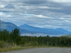
The weather is mostly cloudy today and cool. We turned the fan on in the car and of course all the windows are closed. Traffic is not all that bad today. Mostly RVs with a few semis. No logging trucks even though there are thousands of trees.
Speaking of trees I think I have determined that the tall skinny trees are Western Larch. If that is so the needles turn orange and fall off. I have asked and so far no one seems to know but there are lots of them. I don’t think they log them because they are too skinny to make a 2×4.
The road dropped back into British Columbia for 42 miles. If we had not had the Alaska Milepost book we would not have known.
We encountered a few short patches of gravel road. No sign that they plan to pave them. Makes no sense.

We have been following The Milepost book which tells what things are along the road. We are now on the Alaska Highway which was built by the US Army Corps of Engineers in 1942. Most of what we saw today was trees, lakes, trees, rivers, trees, and creeks. Oh yes and more trees. There are turnouts often. Some are considered rest stops because they have a pit toilet. Many of the creeks were named by someone in the Corp.

We crossed the next to the longest bridge on the highway at 1,917 feet. The floor of the bridge is the metal grating that cause the woodie to swerve all over. The bridge is being replaced with what looks like the same kind of bridge. We took it slowly as advised. We stopped just before the bridge at a rest stop that supposed had a good place to take a picture. It most likely was good at some point but now the trees have grown up too much for picture taking.
Just across the bridge is the First Nation town of Teslin. Most vehicles were stopping here to gas up including us. The book told us to really watch our speed through here. Success, no speeding ticket.
We have been warned to watch for bear, moose and caribou. So far no sightings beyond the black bear at the beginning of the trip.


We stopped at the rest stop just before another bridge painted bright blue. Several others are stopped here too.

We then crossed the third longest bridge at 1,770 feet has a concrete floor. This bridge was built high above the water so ships could pass under. Most of the ships stopped carrying supplies after the highway was built.
We arrived in Whitehorse about 3:00. This town is considerably larger so more traffic. They have a quilt shop so Connie headed out to see it. Great shop. She helped the local economy.
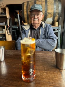
We ate dinner at a beer brewery that was obviously very popular. It wasn’t very big but was always busy. Connie tried a Two Percent Spritzer that Rob was eyeing. That is until he tasted it. Described as a bitter herby flavor.
No problems with our basic transportation today. However, it could use a good bath.
