Day 4 July 5, 2025 Bellingham Washington to 100 Mile House British Columbia 278 miles
We left David and Barbara Ann’s house about 9:30 and headed to Costco for gas. Then we stayed in their parking lot and decided where to go next. Turns out that last year we went to 100 Mile House so we decided to go there again. This part of the trip will be very much like last year. Well, the breakdowns will probably be different.

We left Costco expecting to go north to Vancouver but instead the GPS had us go south toward Seattle for a few miles before exiting to one of the state highways. We traveled through lots of farm land with many large dairies and blueberry farms. One farm had a sign for eggs at $7.00 per dozen.
The border crossing wasn’t too difficult and only took 13 minutes from when we got in line until we were through. We did observe that the Nexus line did move much faster so if you frequently crossed the border it would be worth the investment.

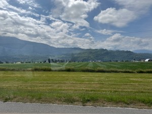
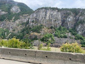
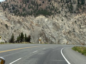
We are on Canada 1 which sure feels like a freeway. The landscape is much the same for 20 miles or so. Then we start through the mountains. They would have been beautiful if not covered with clouds. Thankfully the weather is cooler than last year. During this section we went through seven tunnels. Most were short but a couple were a little longer. Our horn really echoes in them.
We stopped in one of the very small towns for gas since we didn’t want to repeat the earlier experience. One of the other customers noted that we hadn’t even taken the car out of the box. That was a new saying for us.
A very short distance past the gas station the gas cap slid off the hood and onto the running board. Connie was sure it was laying back on the road. Rob retrieved it, put it on the gas tank and off we went. Sure felt lucky with that one. Rob does have a spare onboard.
Only encountered one construction project. It was a big one. We had to wait about 10 minutes for our turn to go.
We went up and down lots of hills but most were not labeled. The one that did have a sign was called Jackass Mountain Summit with an elevation of 1184 feet. We thought the name was funny and the height much shorter than expected.
Another sign indicated big horn sheep were in the next four km. By golly there actually were a few beside the road. Unfortunately no photo this time either.

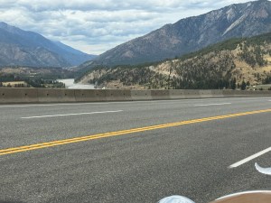
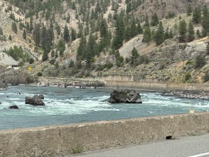
We were following a river that just happened to have train tracks on both sides. At one point there were trains on both tracks. The one on the opposite side of the river must have been at least a mile long. We could never see enough of the front to know how many engines there were. Most of that train was fuel cars. Most of the other train was containers.

Several large signs are now advertising Roadkill BBQ Buffet. Might almost be worth a stop to check it out. We did eventually see the place but didn’t stop.
The sky is getting more clouds and they look more threatening. The wind has picked up and the temperature has cooled down. Our lodging was on the edge of town so we checked in. The skies are really dark now and we can hear thunder. We opted to go to the small corner market rather than the bigger one. This was much closer and we wanted to get as much as possible done before the rain hit. We got our microwave meals just as a big gust of wind hit. We were very fortunate that we got everything done before any rain. Duct tape was used to temporarily fix a potential leak into the trailer pantry.
