Alaska 2024

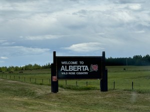
Day 31 August 1, 2024 Grande Prairie Alberta to Dayton Valley Alberta 255 miles

Today is sunny out. The day is supposed to be warmer. Highs expected near 80 throughout the area. We load up and go out to the car only to find the trailer with a flat tire. All those miles on the Dalton Highway that is known for blowing tires and now we get one. Of course changing it here is most likely easier. We had to unpack and repack things in the car and trailer to get to the tools. That did take about an hour to change so we didn’t leave until 9:45. We are currently driving without a “live” spare. The next flat will take more time and effort to repair.

Lots of this today

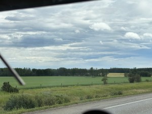
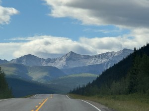
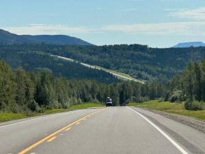
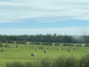
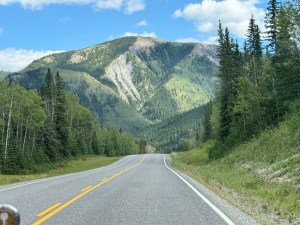
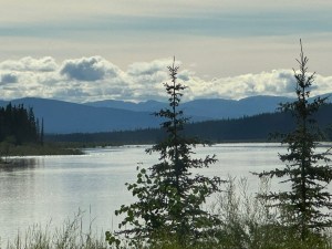
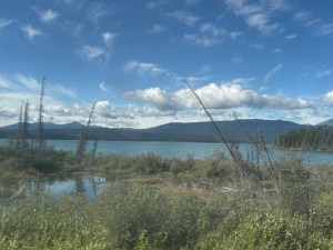
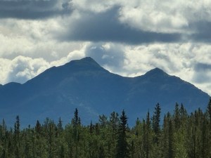
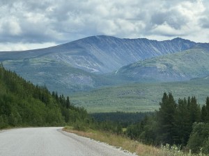
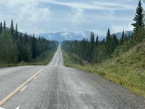
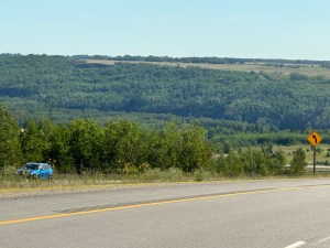
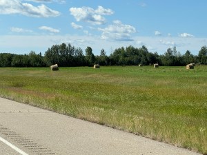
We are definitely in the prairie. The mountains are in the far distance. Lots of large fields of grain or hay. Most of the hay is in large round bales sitting in the field. Only occasionally do we see some of the bales gathered together. Very few are wrapped in white plastic. Most are in what looks like mesh in either green or brown.

Down in the valley

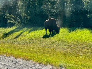
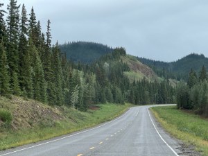
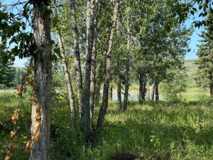
Long rows of trees divide some of the fields. Now they are a mix of pine and deciduous. Most are very tall so they have been there quite some time. There are some cattle and a few horses but not nearly enough to eat all that hay.

Grain field

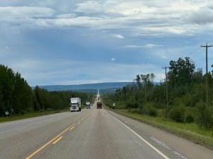
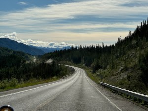
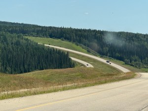
The road is a four lane divided highway. No on or off ramps. At least this way we only have the trucks going the same way. We came to a construction sign but couldn’t see any big equipment. Then we came to brand new asphalt. Well the construction must be finished and they forgot the sign. But wait here is the construction. Looks like they are putting down the last little stretch. Most of it is painted but not all. Sure was nice and smooth.

Hay bales

We stopped in Fox Creek to fill the car and have lunch. We ate at the A&W and forgot to order the whistle dog. We forgot all about it until reading the poster while eating lunch.

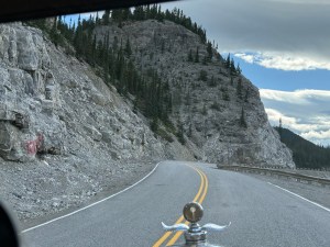
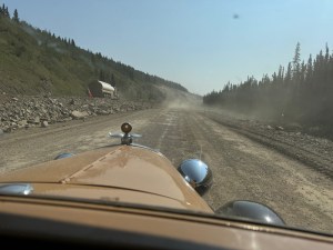
The road for the next hour was terrible. It made some of the gravel stretches on the Dalton look pretty good. The road was extremely rutted and the Model A pizza cutter tires don’t do well with that. Then there are the small humps and bumps that can’t be avoided. Those are the things that really bounce you around. Add to that the small potholes and rough bridge crossings. Seemed like the car would fall apart. But it held together.

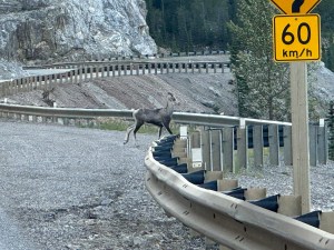
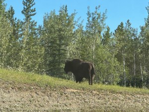
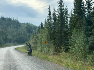
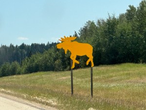
All along this stretch were moose warnings in very large signs. We did see about four moose. The only thing was they were bright yellow and attached to a pole.

Moose sighting

We came to an area that had obviously been hit very hard by a thunderstorm. There had been warnings last night. The grain in one field was almost entirely down. Several others were also badly damaged. Then everything was okay again,

Down the hill, up the hill

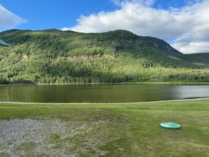
We arrived in Drayton Valley a little after 4:00. We are staying at the Best Maple Leaf Inn. It could use some minor repairs on the outside but the inside seems fine. The owner says the town has a real homeless problem but if they come around his hotel he gets the stick. He is a big guy so they do go elsewhere.

Alaska 2024

Day 30 July 31, 2024 Pink Mountain RV Park British Columbia to Grande Prairie Alberta 221 miles

We got an earlier start today. We were on the road by 8:00 am. It’s mostly cloudy this morning.

Natural gas was discovered along the route today. We see plants and work camps. The find was huge. They can pump 271 trillion square feet per year for 100 years. This area supplies natural gas for most of Idaho, Oregon and Washington.

The traffic has really picked up. The number of semis in particular. They also seem to be going well above the speed limit. We must have seen at least 10 prefab buildings going north. They look like some kind of housing. Perhaps a big construction project or more to do with the natural gas. At about kilometer post 138 one of those north bound trucks threw a rock into our windshield in the lower corner on the driver’s side. Shards of glass landed on Rob’s face, hand and leg. They also landed on the seat. It left a huge star in the windshield too. All those miles on the Dalton Highway without a rock chip and now on pavement we get a big one. A new windshield is now on the project list for when we get home.

Cracked windshield

On the better side we saw two deer grazing on the grass in the right-of-way. They were well off the road and didn’t move much with all the traffic.

The wind has picked up again and the clouds look more like rain. In fact it did start raining before long. Luckily not too hard but there is enough dust or something in the air that the passenger window is quickly impossible to see out. This is important since the chief navigator sits on the passenger side.

We crossed the Peace River Bridge. This is the longest bridge on the Alaska Highway at 2,130 feet. Unfortunately for us it is a metal grated floor and this time the traffic is nearly bumper to bumper. We go slowly but luckily there are not too many behind us. We did get over the bridge before the rain started.

Right after the bridge was a long steep climb up a hill. We didn’t have our speed up because of the bridge so part of the way was in first gear. Thank goodness the temperature outside was cool so the car didn’t overheat.

Today in the mix of semis were logging trucks. We haven’t seen them since we started. They must not log as much on this highway.

Ending at the beginning of the Alaska Highway

The rain was nice enough to stop when we got to Dawson Creek. That is where the Alaska Highway starts. We found the sign marking the spot and took a picture. Then we ate lunch with a couple of bikers we met along the way. Fun diner called Stuie’s. It was all decked out for the 50s.

Sign under the arch

Not far out of town a doe and a fawn started to run across the road. Rob honked the horn and they turned around. Thankful for that because we most likely would not have been able to stop in time.

So far to go

Some of this land today has been farm land. Mostly pasture or some kind of grain. The mix of green and gold is really pretty. Too bad the windshield is so dirty. One of those farms appeared to be raising elk. Might be the cheapest way to get your elk meat. Oh, we saw some elk today.

Farm land

We arrived in Grande Prairie about 4:15 but had to take quite a detour for road construction to get to our hotel. The person or persons upstairs above our room are walking back and forth a lot. We are both pretty tired tonight so some noise will not bother us.

Alberta

Alaska 2024

Day 29 July 30, 2024 Toad River BC to Pink Mountain BC 255 miles

View from cabin window

We took off at our usual 9:00 am. Today is partly cloudy with a gentle breeze. Last night the breeze stopped and the lake became like a mirror. This morning there are gentle ripples in the water.

Starting the day

The beginning of the day required us to cross two bridges with metal floors. They cause the car and trailer to wiggle all over. Luckily there was no traffic coming the other way on either bridge. It’s so much easier driving down the middle. The bridges aren’t all that wide to begin with.

Just another mountain

We came to the washout that had closed the road a few days earlier. They have it open for one lane. We didn’t wait long. Water must have come down the mountain rapidly and removed all of the lane closest to the river, no crews working on it today. They probably have to go out to bid or some other crazy thing. A person in a pickup is at each end controlling the stop lights. They both looked incredibly bored.

Stone sheep
Same sheep

Rob spotted our main wildlife for the day. Just over the guard rail was a young Stone Sheep. They are mainly found in northern British Columbia. They are smaller than the common big horn sheep and they are darker in color. This one was very cooperative as it jumped over the guard rail into the turn out. We stopped on the road and got a few shots before it went back over the guard rail and down the hill. We saw watch for moose, deer, caribou, sheep and horses signs but only saw the one sheep.

Similar area

We are climbing up the summit that is the highest on the Alaska Highway at about 4500 feet. Surprisingly the assent and dissent were more gradual than expected. Maybe that means the rest of the day will be less. Well there were more hills during the day most of which had longer steeper assents and dissents. Naturally we slow way down. Most didn’t have passing lanes. The traffic seemed light today and we did not hold any vehicles up.

Long road ahead

At the top of the summit is a small lake and nice campground. A few of the campsites were right at the edge of the lake.

Went through another area where a wildfire had occurred perhaps last year. The green ground cover had returned. The logs are being harvested because they were stacked ready to load on a logging truck.

A car passed us on a long flat straight section of road with no oncoming traffic. Well that part isn’t unusual but this person cut back so soon they missed our front bumper by less than a foot. Rob honked several times but the car was a quarter of a mile down the road already. So far this was our closest encounter on the trip.

Baled grass

The road straightened out into a small valley. A couple of large fields of baled grass hay in them. They are the big marshmallows that have not turned white yet.

We stopped in Fort Nelson for lunch. We chose Amanda’s Northern Delights. The food was really good and reasonably priced. Stop by if you are in the area.

Then we went across the road to the museum. They advertise it as the finest collection of antique cars in British Columbia. Well don’t know what else is in the province but this doesn’t come close to what was in Fairbanks. The museum is quite large so you could spend several hours there if you wanted. They did have one 1930 Model A coupe.

Car in the museum

We fueled up again and got on our way. We didn’t spend much time at the museum. We are only about half way of todays journey. The wind has greatly increased. Our gas mileage won’t be so good this next time.

We have noticed that fewer motorcycles are on the road today. Of course it isn’t the weekend. There are also more pieces of retread from tires. Some in small pieces and some rather large.

One last section of construction for the day and it is right in front of the RV park we plan to spend the night in. We are staying in the Pink Mountain RV Park. Supposedly there is a mountain nearby with pink coloring. We didn’t see it on the way here. Rob thinks that you have to be on drugs if you want to see a pink mountain.

Alaska 2024

Day 28 Watson Lake YT to Toad River BC 203 miles

At the sign forest
Entrance to the Sign Post Forest

We left the hotel and went to the Sign Forest. Such a fun place to visit. It started when the Alaska Highway was being built In 1942. When people come to visit they post a metal or wood sign somewhere in the forest. There are signs from all over the world. Some are small and some are large. Some are even license plates. Tall posts have been placed at the north end of Watson Lake. As a post fills up new ones are added. There are now over 77,000 signs. There is no charge to wonder through. There is also no charge for putting up a sign,

Today is mostly sunny but as the day progresses the skies get more cloudy. No rain however.

First bison
Black bear

We spotted a large dark object up ahead. Most likely a rock or roots of a downed tree, Then the tail moved. It’s a wood bison. Then it moved more and revealed a calf. A closer look found several other bison in the trees. Wood bison are smaller and darker in color than the plains bison found in Yellowstone.

Second bison

A little further down the road we spotted a small black bear. We guessed it might be a yearling. Amazing two big wildlife sightings in the same day. By the end of the day we saw one more bison and three more bears. Very exciting day. They were all in the large right of way next to the road.

One of the rivers

We have noticed that the number of campsites is much less than in the Yukon. There are still lots of RVs on the road. Today seemed to have more really big RVs. Another tour group is headed north. We could tell because they had a sticker in the upper corner on the driver’s side.

All of them were large motor homes or large fifth wheel trailers. If they are headed to Dawson City they won’t be able to park in the Gold Rush RV site like we did. They are all too big.

We stopped at Coal River for fuel and realized we had stayed here two years ago when we drove coast to coast in Canada. We did stay for lunch. We each had bison burgers with onion rings. Very tasty. This time there was not a herd of bison right outside of the dining room window.

Major construction is taking place on the last suspension bridge remaining on the Alaska Highway. They are drilling out all the places where the concrete has broken. They should have just done the whole thing. They have more holes than remaining surface.

We did a second fuel stop at Rockies Lodge. We had stopped here before as well. We tend to fuel the car more often than in the States. Quite a few of the gas stations on the Alaska highway have closed down.

Muncho Lake

One last piece of construction near Muncho Lake. It didn’t require a pilot car just one lane of traffic. Muncho Lake today at least was a beautiful shade of green. A heavy runoff must occur each spring because large gravel channels come out of the mountains and down to the lake. Not only would these hold lots of water there were lots of them.

Almost done for the day

The wind really picked up at this point too. The roads have been more bumpy since we arrived in British Columbia. When you combine bumps and wind it makes the ride a bit rough. Rob kept checking for a flat tire. Over 5,000 miles now without a flat and life is good.

We came to the complex called Toad River. They have it all. Gas, restaurant, gift shop, cabins and RV park. They have no remaining drive throughs at the RV site so we took a cabin. It has one window that looks out on the river. The driver/mechanic looked like he needed a rest. We just finished supper and the navigator is already asleep.

Alaska 2024

Day 27 July 28, 2024 Whitehorse Yukon to Watson Lake Yukon 275 miles

Start of the day out of Whitehorse
Marsh Lake
Further down Marsh Lake

Today is a 50 50 mix of sun and clouds. Not supposed to have rain however. Rob bought breakfast from the hotel yesterday. We had one American and one British. We think the cook is new at his job. The coffee and tea water were warm. The American breakfast included two dollar size pancakes one of which was burnt and the other was close. The over easy eggs were sunny side up and almost overdone. The toast came unbuttered and was too cold to melt the butter. When we left the hotel we discovered a McDonald’s just around the corner. That had to have been better. However, the breakfast was filling.

Marsh Lake is about 20 miles long
Seems never ending

We got fuel on the corner and then headed to Walmart to get ice. Well they don’t sell ice. Not sure if that is all Walmarts or only that one. They sent us across the street to a grocery store.

Near Johnson’s Crossing

We saw quite a few bicyclists today. Much easier highway than some of the others we have seen. Only a few spots of gravel roads today and one detour around a bridge replacement. More semi trucks but no logging trucks. Lots of RVs of all flavors.

From bridge at Johnson’s Crossing

We drove this same stretch of road on our way up only in the opposite direction. The area has lots of lakes and rivers so there are lots of opportunities to participate in water related activities. Government campgrounds are numerous. They don’t have hookups nor do they have showers. They do have pit toilets and picnic tables. The fee is $20 Canadian per night. You can also overnight in a turnaround.

Teslin Lake

We made one more fuel stop and then ate lunch near Morley Lake. No picnic tables at the location so we ate in the car. Bonus: Few mosquitoes.

Near Watson Lake

As we came into Watson Lake we drove past the sign forest. We will go back for a visit tomorrow. We stopped their with the modern car several years ago. More about it tomorrow.

Closer to Watson Lake

We got in our room by about 5:30. The grocery store is across the street so we walked over and bought a few things. Pork chops were a little over $8.00 US per pound.

Interesting mountain

The car stopped much better today. Yesterdays maintenance time paid off. We left the manifold heater on all day and with light jackets the temperature was comfortable.

Alaska 2024

Day 26 July 27, 2024 Pelly Crossing Campground to Whitehorse Yukon 179 miles

We had canned chicken on lettuce salad mix for dinner last night. There were lots of small bees around bothering our meal so we put the can with a few remaining scraps at the opposite end of the table. When preparing for bed we checked the can. It was absolutely sparkling clean.

Just out of Pelly Crossing

About the time we usually get up a light rain began to fall. The temperature was cooler as well. We ate breakfast in the car and by the time we finished so had the rain. Still very cloudy however.

Long road ahead

The pavement was wet all the way to Whitehorse. Eventually the rain came down hard enough to turn on the windshield wiper. Too many dots on Connie’s side to take many pictures.

Low hills

We came to the construction site of the day. A bridge was being replaced. They had a one lane road and bridge around it. Traffic flow was controlled by a stop light on each end. This light had a timer on the bottom light indicating the amount of wait time remaining. Sure wish this was on more of the lights.

Mountain ahead

After a surprising distance we finally caught up with the bicyclist who had stayed in the same campground last night. He said he was hoping to get as far as Carmacks. He left the campground at four in the morning. That way he could avoid the heat of the day. He shouldn’t have to worry about much heat today. We honked and he waved. Then coming from the opposite direction was another bicyclist. That was the only two we saw all day.

Bicyclist from last night

We are following the Yukon River most of the time. It’s a very large river at this point so you know why it was the main source of travel and supply shipments during the fur trade and the gold rush. We do go over a few hills but they are small in comparison. When we aren’t by the river we are passing lakes that have lots of waterfowl in the spring and fall. None today unfortunately. There are also supposed to be beaver, moose, muskrat and mink. We saw none of these. A large elk herd is supposedly in the area as well. All are hiding except the chipmunks.

Straight stretch

At the top of one of the hills we encountered some dense fog. Thankfully it didn’t last long. It is much better than dense dust.

Pretty clouds

We arrived in Carmacks after crossing the bridge over the Yukon River. The car is definitely a novelty here. This community was an important stop for river boat travel. Now since it is on the highway it manages to stay alive. The population according the Milepost book is 588. We have learned however that the Milepost isn’t always correct.

Yukon River

A semi passed us on a hill in a no passing zone and nearly caused the car coming from the other way to drive off the road. Some of those drivers get very impatient. He had not been waiting behind us. He was just driving too fast.

No rain

All along the drive today there have been government campgrounds. We see lots of pickups with campers and trailers. The trailers seem to come in all sizes. Teardrops all the way to huge fifth wheels. Not so many of the big motor homes. The majority of RVs seem to be small to mid size.

Closest we have come to big horn sheep

We arrived in Whitehorse about 12:30. We stopped for lunch at the Smoke and Sow. It is a small barbecue diner. The food was pretty tasty.

Coming into town an electronic sign indicated a road closure at some milepost due to a mudslide. We have no idea where that might be. Whitehorse has several highways coming together and we are certainly not familiar with any of them.

After lunch we went to the Visitor’s Center to find out about the roads. They were very helpful and showed us where the slide is located. It is on our planned route. Fortunately they have it open to one lane traffic. Most likely more by the time we get there in the next day or two. She advised checking with the Visitor’s Center in Watson Lake when we get there.

We proceeded to the hotel where Connie slept the rest of the afternoon and into the early evening. Must have been more tired than she thought. Rob took a short nap and then went out and adjusted the brakes, put more air in one tire and checked the power for the GPS. He also ordered breakfast for tomorrow. If you ordered today the fee was $10 each. Tomorrow the cost is $15 each. He ordered one British breakfast and one American breakfast. It will be the toss of a Canadian coin tomorrow that determines what breakfast will be in the morning.

Alaska 2024

Day 25 July 26, 2024 Dawson City Yukon to Pelly Crossing Yukon 156 miles

We got a later than normal start today. We didn’t leave Dawson City until nearly 10:00 am after a Visitor Center stop and a fuel stop. We wanted to ask about the road to Deadhorse since we heard yesterday that it might be closed. No reported closures which is good. The ladies at the Visitor Center came out to have their pictures taken near the car.

Dredge pile

Dawson City is an old mining town that has now become a tourist attraction. Many of the buildings have been restored or built to look like the original. We saw a tour group in town in addition to the First Nation folks. On the way out of town we noticed that one of the campgrounds was full of Airstream trailers. They must have been the other tour group. With as many lodging options as there are tour groups and festivals must be common. We learned later that the weekend before was a music festival. They told us in Tok that many tour groups fly into Dawson, look around and then fly into Fairbanks to continue a tour.

Yukon River

Out of town are all the dredge piles. They go for at least a couple of miles long and quarter mile wide. The river must be deeper and wider than originally. One subdivision was built on the dredge piles and was called Dredge Subdivision. Didn’t sound very appealing.

Yukon River again

We saw three bicyclists again today. These didn’t have chase cars and were fully loaded to spend the night on the road.

Gravel Lake

The area we are driving through is called the Tintina Fault. It extends over 600 miles through British Columbia, Yukon Territory and Alaska. It is the longest fault in North America and runs parallel to the Yukon River. Lots of migrating birds follow this path. Gravel Lake is part of the route. Rare birds can be seen here in the spring and fall. There was one vintage Robin here today.

Construction

The trees are finally including types other than black spruce. The large right-of-ways are full of brush on average three feet tall. If there are milepost signs they are well hidden.this makes following The Milepost book more difficult.

More of the construction

We encountered a few miles of gravel road. The rest of the highway has been fair to good asphalt. One section was newly redone because it didn’t have potholes yet. Plus The Milepost said to prepare for rough road.

Still more to go

Well we came to the construction. It went for 7-8 miles. This will be a major rerouting of the existing highway. In one place they are making a huge cut in the mountain. It’s going to be wider and shorter than before. They are running pilot cars in both directions. Must have something to do with the length of the construction because there don’t seem to be that many vehicles.

Wildfire out further

We filed with gas at Stewart Crossing and then had lunch. An electronic sign is warning of wildfire all the way to Pelly Crossing. Another vehicle stopped to look at the car. They had just come through the area and said not a problem. He said that the town of Jasper north of Banff and Lake Louise lost over 300 structures. That is so sad because it is a beautiful place.

Sign in grocery store

We could see a few smoking spots across the river and eventually small spots right bye the road. The fire has been much worse because both sides of the road had burned recently. We don’t know the size of the fire but it looks like lots of acres.

Bridge view from campsite

We arrived in Pelly Crossing about 3:30. Filled with gas again and went into the grocery store we a salad and some ice tea. A sign near the beverages said they refuse to sell energy drinks to anyone under the age of sixteen without parental permission and the parent must be present.

River view from campsite

Across the highway is a free campground so we went over and found a spot. It is right near the river with a view of the bridge. Only badge thing are the little bees. No stings yet but there is still time.

We lost a nut on one of the tailgate hinges on the car. Not a show stopper. Just need to put it on the list for when we get home. Bailing wire is so nice to temporarily fix things.